Directions
USE GOOGLE MAPS!
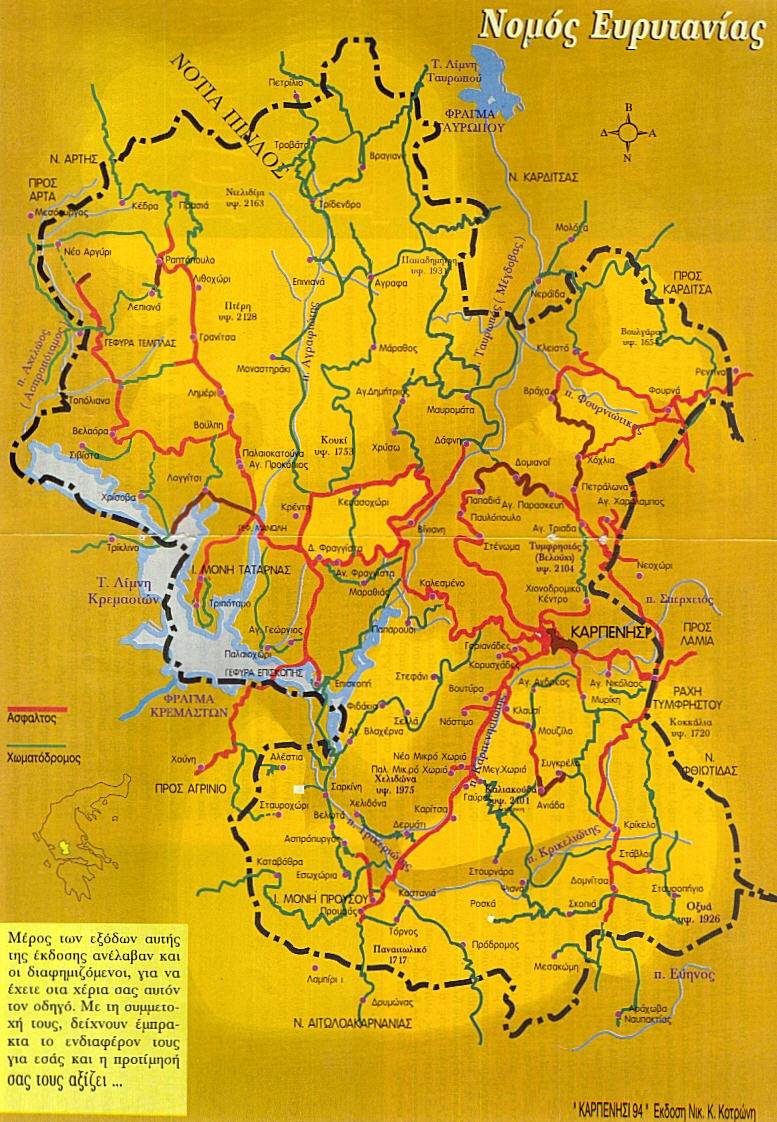
As this is a remote region, it will be important to recognize Greek names, particularly those on maps and road maps.
We list in Greek the towns referenced in this section (small letters, capitalized, English phonetics).
| Καρπενήσι | ΚΑΡΠΕΝΗΣΙ | Karpenisi |
| Ευρυτανίας | ΕΥΡΥΤΑΝΙΑΣ | Evritania |
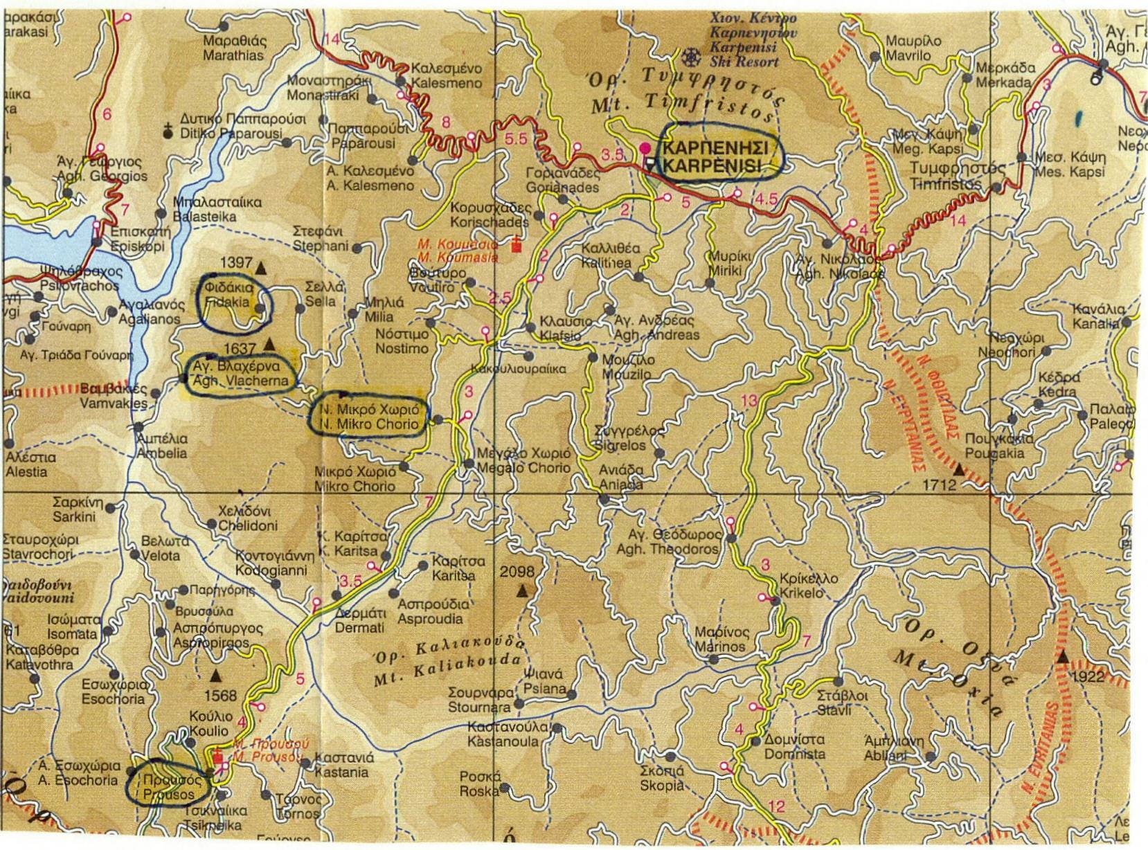
| Φιδάκια | ΦΙΔΑΚΙΑ | Fidakia |
| Αγ. Βλαχέρνα | ΑΓΙΑ ΒΛΑΧΕΡΝΑ | Agh. Vlacherna |
| Μικρό Χωρίο | ΜΙΚΡΟ ΧΩΡΙΟ | Mikro Chorio or Mikro Xorio |
| Γαύρος | ΓΑΥΡΟΣ | Gavros |
| Προυσός | ΠΡΟΥΣΟΥ or ΠΡΟΥΣΟΣ | Prousos |
| Κερασοχώρι | ΚΕΡΑΣΟΧΩΡΙ | Kerasshori |
| Αγραφά | ΑΓΡΑΦΑ | Agrafa |
| Τροβάτο | ΤΡΟΒΑΤΟ | Trovato |
| Βελούχι | ΒΕΛΟΥΧΙ | Velouxi or Velouch |
| Τυμφρηστός | ΤΥΜΦΡΗΣΤΟΣ | Timfristos |
| Αγ. Γεώργιος | ΑΓ. ΓΕΩΡΓΙΟΣ | Agh. Georgios |
| Λαμία | ΛΑΜΙΑ | Lamia |
Some old maps that might be useful:
old City Map
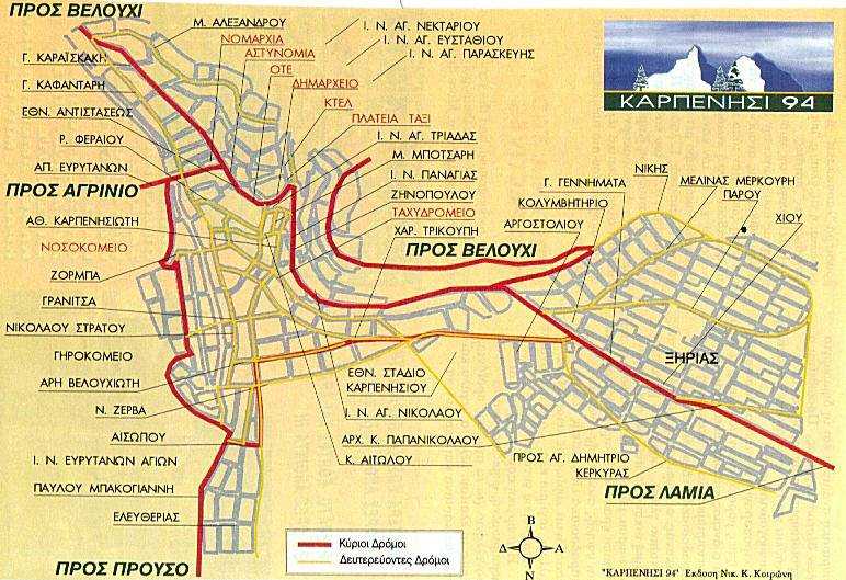
When you cross the ridge of Timfristos to enter Karpenisi, you will think you are entering a valley.
This is an illusion.
Karpenisi is at an altitude of 960 meters.
You will only realize this once you go to the village of Fidakia (which is about 50 meters lower than Karpenisi)
and see how far up you are as you look down upon the lake.
The town itself is not exactly well organized
or pretty.
Being the center of a poor province, it is difficult to implement proper zoning and building codes.
So do not freak out if you see some imperfections.
You will, however, find beauty in the town square.
Make sure to sit outdoors and sip some coffee or have some Greek deserts.
You should also drink the fresh spring water from the fountain in the square.
Copyright © 2002-Present. All rights reserved.
Photos on this site are Copyrighted. Copying and use of these without expressed written permission from this site's owners is strictly prohibited.